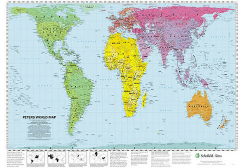

Peters World Map
In Stock
Quantity
Description
This accurate, colour-coded map shows all areas according to their actual size, with the North-South lines running vertically and the East-West lines running parallel. The poster features a brief discussion of the tendency of traditional maps to show countries incorrectly in proportion to one another, and describes the 'growing awareness of the interdependence of all nations and all peoples.'
More Details
- Imprint: Schofield & Sims Ltd
- ISBN13: 9780721709338
- Packaged Dimensions: 770x530mm
- Publisher: Schofield & Sims Ltd
- Release Date: 2002-02-21
- Binding: Poster
Delivery Options
Home Delivery
Store Delivery
Free Returns
We hope you are delighted with everything you buy from us. However, if you are not, we will refund or replace your order up to 30 days after purchase. Terms and exclusions apply; find out more from our Returns and Refunds Policy.