
Description
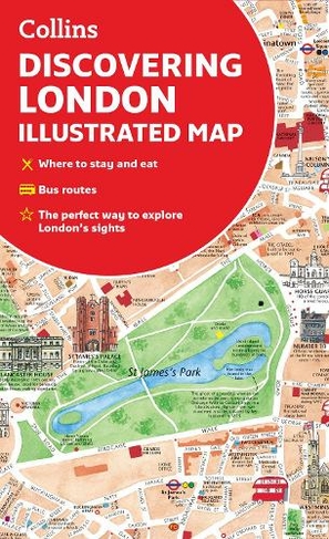
A new edition of London's most original map. This hand-watercoloured map contains individual paintings of all the main sites and landmarks, shop-by-shop street maps, theatres and cinemas, comprehensive travel information and index. This detailed map of Central London is at a scale of 1:8,250 (7.5 inches to 1 mile).
Coverage extends from Regent's Park in the north to Battersea in the south, and from Kensington in the west to Tower Bridge in the east.
This attractive and fact-filled map would make a lovely souvenir for the visitor to London.
The map features:
* Railway stations, bus routes, London underground map, taxi ranks and car parks
* Shop-by-shop street maps for Oxford Street, Bond Street, Covent Garden, Portobello Road, King's Road, Brompton Cross, Exmouth Market, Beauchamp Place, St. Christopher's Place and South Molton Street, Knightsbridge, Jermyn Street and Kensington
* London's theatres and cinemas
* Places to eat, internet cafes and good places for a picnic
* An inset map of the City of London
* Comprehensive index
* Historical and contemporary anecdotes
Other titles in the series:
Discovering Edinburgh
Discovering Dublin
Discovering Glasgow
About the Author
Explore the world through accurate and up-to-date mapping.
More Details
- Contributor: Dominic Beddow
- Imprint: Collins
- ISBN13: 9780008492618
- Number of Pages: 2
- Packaged Dimensions: 113x205x9mm
- Packaged Weight: 80
- Format: Maps
- Publisher: HarperCollins Publishers
- Release Date: 2022-03-17
- Binding: Sheet map, folded
- Biography: Explore the world through accurate and up-to-date mapping.
Delivery Options
Home Delivery
Store Delivery
Free Returns
We hope you are delighted with everything you buy from us. However, if you are not, we will refund or replace your order up to 30 days after purchase. Terms and exclusions apply; find out more from our Returns and Refunds Policy.