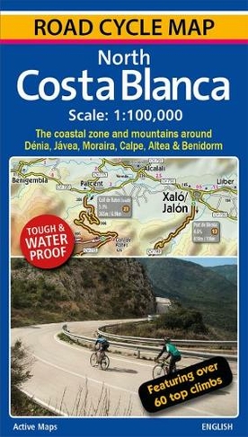

Description
A 100,000 scale detailed road cycle map for North Costa Blanca (the coastal zone and mountains around Denia, Xabia/Javea, Moraira, Calpe, Altea & Benidorm). Easy cycle route planning with road classifications, distance markers between key junctions, top climbs, spot heights and relief representation. Includes 11 classic route suggestions that pass through valleys, go high up into the mountains, visit unspoilt villages and towns and meander along the coast. Features over 60 top climbs marked on the map with details of gradient, ascent and length (Coll de Rates, Port de Tudons, Confrides, Cumbre del Sol, Port de Bernia, Miserat, Vall d'Ebo, Coll de la Garga, and many more). Some of the key inland towns on the map include Tarbena, Castell de Castells, Xalo/Jalon, Pego, Villalonga, Sella, Guadalest, L'Orxa, Benifallim, Planes, Muro de Alcoy). The map is printed on tough and waterproof paper.
More Details
- Contributor: Richard Ross
- Imprint: Active Maps Limited
- ISBN13: 9780955919114
- Packaged Dimensions: 119x210mm
- Format: Maps
- Publisher: Active Maps Limited
- Release Date: 2018-05-31
- Binding: Sheet map, folded
Delivery Options
Home Delivery
Store Delivery
Free Returns
We hope you are delighted with everything you buy from us. However, if you are not, we will refund or replace your order up to 30 days after purchase. Terms and exclusions apply; find out more from our Returns and Refunds Policy.